sci.geo.* — the earth sciences
Geology, oceanography, meteorology and their neighbours. The branch mixed professional geoscientists with dedicated amateurs, and its field-report threads have outlived many of the institutions that employed the posters.
On this page
- Twelve names and nothing at the top
- The first three, 1990 to 1991
- 1994, the year the branch tripled
- Three proposals that did not work the first time
- The last two names, 1998 and 2002
- Who was in the room, on the evidence of the paperwork
- The observation culture
- The instrument and the witness
- Reporting an earthquake
- Satellite navigation, and a policy that changed a subject overnight
- The weather year
- The climate argument
- The archives arrived while the groups were still running
- Where it went
- Scope and limits of this page
Twelve names and nothing at the top
sci.geo is an address with no room behind it. Nobody posted to sci.geo, because there was never anything called sci.geo to post to: the name existed only as the shared prefix of its children, in the way sci.bio, sci.space, sci.psychology and sci.electronics also did. The edition of the Internet Systems Consortium’s master files consulted while this page was written lists twelve names beginning sci.geo and nothing called sci.geo itself. Those twelve sit inside the 185 sci.* names the same files carry. What those files are, and what their columns do and do not tell a reader, is explained on comp.* and not repeated here; the hierarchy they belong to is described on sci.*.
The twelve, with the one-line descriptions the master file still pairs them with:
sci.geo.cartography— Maps, grids, coordinates, projections, datums.sci.geo.earthquakes— For discussion of earthquakes and related matters.sci.geo.eos— NASA’s Earth Observation System (EOS).sci.geo.fluids— Discussion of geophysical fluid dynamics.sci.geo.geology— Discussion of solid earth sciences.sci.geo.hydrology— Surface and groundwater hydrology.sci.geo.meteorology— Discussion of meteorology and related topics.sci.geo.mineralogy— Mineralogy, rock hounding and related topics.sci.geo.oceanography— Oceanography, oceanology and marine science.sci.geo.petroleum— All aspects of petroleum and the petroleum industry.sci.geo.rivers+lakes— Science of rivers and lakes.sci.geo.satellite-nav— Satellite navigation systems, especially GPS.
All twelve are flagged y in the active file: unmoderated, open to posting. There is no moderated group anywhere in sci.geo.*, and that turns out to be the rule rather than the exception at this end of the hierarchy. Counted in the current master file, none of the four largest second-level branches of sci.* — sci.med with 26 names, sci.engr with 25, sci.bio with 15 and sci.geo with 12 — contains a single moderated group. Moderation in sci.* clusters instead in the smaller branches: two moderated names each in sci.physics, sci.astro, sci.space and sci.psychology, one each in sci.math and sci.crypt, and the hierarchy’s answers group, sci.answers. The big applied departments were left open, and the theoretical ones were not. Why moderation existed in sci.* at all, and what it was for, belongs on the parent page; what belongs here is that the branch did make exactly one attempt at a moderated group, over the winter of 1992 and 1993, and lost it by two votes.
The descriptions are archaeology rather than editing. Nobody has revised them since the people who proposed each group wrote them into a control message, and the wear shows. sci.geo.eos is filed under “NASA’s Earth Observation System”, which is not the programme’s name: the Earth Observing System is what NASA called it, and the slip came in with the 1994 proposal and has stayed in the master file ever since. sci.geo.mineralogy names mineralogy and rock hounding in the same breath, which is a fair statement of who was expected in the room. And sci.geo.rivers+lakes carries a plus sign, one of only two in sci.* — the other is sci.engr.radar+sonar — and one of twenty-two in the whole Big Eight, five of which are C++ groups.
What the twelve amount to is not a taxonomy of the earth sciences. It is a record of which subjects had somebody willing to do the paperwork. There is no glaciology group, though one was proposed. There is no volcanology, geodesy, soil science or palaeontology group; palaeontology went to sci.bio.paleontology on the biological side of the namespace, and geographic information systems went to comp.infosystems.gis on the computing side. Mining, surveying and geomechanics are not in sci.geo.* at all but in the engineering branch, as sci.engr.mining, sci.engr.surveying and sci.engr.geomechanics — a reminder that the second level of a sci.* name recorded which department a proponent thought they belonged to, and that earth scientists and earth engineers did not always agree.
The first three, 1990 to 1991
The branch opens with a document that does not quite match the group it produced. On 30 March 1990 Jerry Miller, at the University of Miami’s Rosenstiel School of Marine and Atmospheric Science, posted a call for discussion for a group to be called sci.geophysical-fluids. His stated intention was “to provide a forum primarily for scientists working on physical problems in the atmosphere, ocean and molten earth”, with topics running from observations and observing systems through statistical, analytical and numerical modelling to turbulence, cloud dynamics and climate modelling. The discussion period he set ran through April 1990. That call for discussion is the only piece of the group’s paperwork the archive holds; what emerged carried the branch prefix instead, as sci.geo.fluids, and the earliest control message the archive preserves for it is a rebroadcast by a site in May 1991 rather than the original creation notice. The name change is itself informative: in 1990 the namespace was still deciding whether the earth sciences were a department or a scatter of top-level subjects, and it settled on a department.
The department’s anchor tenant arrived next. The call for votes for sci.geo.geology went out from [email protected], an address belonging to Tom Williams of the Department of Geology in Stanford University’s School of Earth Sciences, and the ballot ran from 21 December 1990 to 22 January 1991. The result, posted on 3 February 1991, was 266 votes for and 11 against; the newgroup control message creating the group went out on 18 February 1991. The charter is worth reading because it states, in 1991, exactly what the branch would spend the next fifteen years doing. It opens by quoting Webster’s definition of geology, lists plate tectonics, petrology, volcanology, structural geology, palaeontology, basin analysis, seismology, palaeomagnetism and palaeoclimatology among its subjects, and then explains the purpose in three clauses: the group would be pitched at a level “relevant and informative to active researchers” while remaining open to general discussion; it would host “discussions, debates, and comments that are less formal and more timely than is possible in juried scientific journals”; and it would be “a clearinghouse for exchange of information, including ideas, programs, images, data, and citations”.
Those last two clauses are the whole case for a scientific newsgroup, written before anyone had a web browser to make it easier. Faster than a journal, and a place to pass files around: in January 1991 the images and data in question would have travelled as encoded text or as an anonymous FTP address typed into a posting, but the ambition is unmistakable, and the archives described at the end of this page are what eventually delivered it.
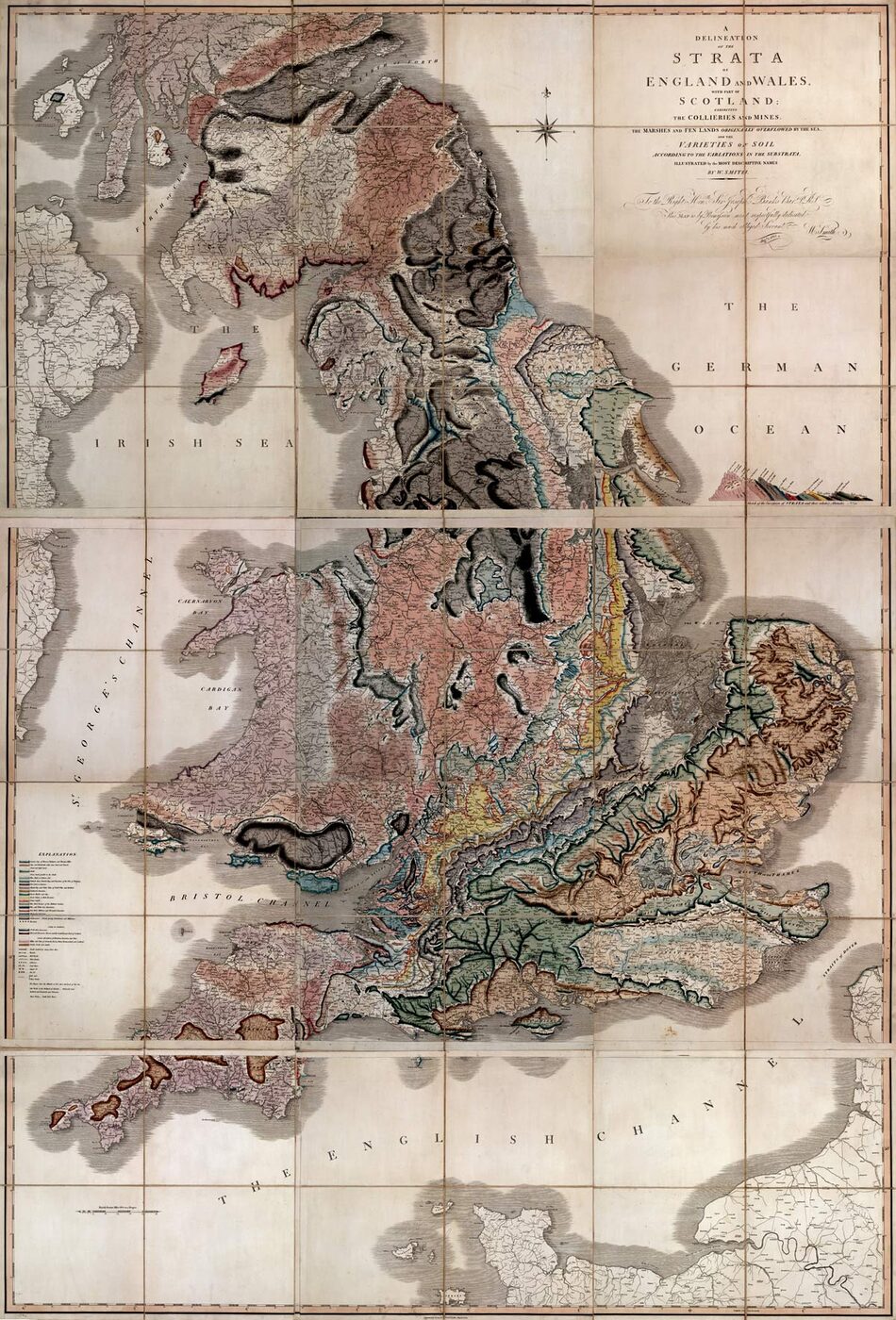

Meteorology followed within weeks. Jason J. Levit posted a call for discussion on 5 March 1991, cross-posted to eleven other groups from sci.physics to sci.aeronautics, proposing sci.geo.meteorology as “an open forum to discuss the dynamics and uniqueness of our atmosphere”. His justification lists what was exciting about the field that year: supercomputers and chaos theory, severe-storm and tornado research, new kinds of radar, microbursts and wind shear, hurricane research, lightning and global warming. It also names, in a single sentence, the three constituencies the whole branch would turn out to have: the group “would be a benefit to professionals in the field, students, and the general public”. Levit signed his postings “Tornado Chaser Extraordinaire”, which tells a reader something about the population he was writing for. The vote passed 178 to 17 on 16 April 1991, and the group was created on 22 April.
Those three — solid earth, atmosphere, and the shared mathematics of a rotating stratified fluid that both are made of — were the whole of sci.geo.* for three years. It is a defensible carve-up of the earth sciences, and it is also the smallest one that anybody bothered to defend.
1994, the year the branch tripled
Then, in a single calendar year, sci.geo.* went from three groups to nine. Six passed in 1994, and the tallies are large enough to be worth setting out together, because they are the only quantitative evidence anywhere about who cared about what.
- sci.geo.satellite-nav — passed 452 to 16, result posted 9 March 1994; created 15 March.
- sci.geo.eos — passed 214 to 21, result posted 29 March 1994; created 4 April.
- sci.geo.hydrology — passed 408 to 12, result posted 12 April 1994; created 18 April.
- sci.geo.oceanography — passed 620 to 9, result posted 18 August 1994.
- sci.geo.petroleum — passed 1,284 to 18, result posted 30 August 1994; created 6 September.
- sci.geo.earthquakes — passed 279 to 19, result posted 15 December 1994; created 21 December.
The petroleum figure is not a misprint. The result records 1,284 yes votes and 18 no, for 1,302 valid ballots, with four abstentions and four spoiled papers, and it was posted in two parts because the list of voters would not fit in one article. The threshold for passage was a two-thirds majority and at least a hundred more yes votes than no; this ballot cleared it by twelve times over. The proposal explains the size. It was submitted by James Huang, of a risk and engineering consultancy at Kjeller in Norway, but it names sixteen proposers, at BP, ARCO, Schlumberger, BHP, Syncrude, Oryx and several oil-service firms, and at universities in Edinburgh, New South Wales, Adelaide and Gothenburg. This was the industry organising itself, and its charter reads like a document written by people who had sat through too many conferences: the group would be “an informal electronic conference venue for specialists of varying backgrounds”, allowing “the rapid and timely discussion of petroleum-related issues that would normally take months or years in journals or at international conferences, or in the public media”, with explicit room for “technical experts, managerial staff, government and environmental organisations and the general public”. One curiosity survives in the record: the one-line description in the winning result of 30 August reads “Discussion forum for the petroleum e&p industry”, while the creation message a week later carries the line the master file still uses, “All aspects of petroleum and the petroleum industry.” The description was rewritten between the ballot and the newgroup, and no document in the archive says who did it or why.
The hydrology proposal came from Upmanu Lall at Utah State University, whose charter promised a forum for surface and groundwater hydrology, water quality, water resources management and policy, and then added something that dates the document exactly: an intention to “set up and manage an electronic archive accessible through ftp, gopher, www, and mosaic” as a repository for contributed manuscripts, software and data-source identifiers, operating alongside the newsgroup. February 1994 is the moment at which all four of those words could be listed as equals. The proposal also states, as the proponent’s own justification, that the hydrology section was the largest single section of the American Geophysical Union, and reports an informal survey of the need that drew about thirty replies, all positive.
The earthquakes proposal, from Ted Smith of the California Division of Mines and Geology on 20 October 1994, is unusual in being an argument about geography rather than about subject. Its rationale is that ca.earthquakes — a regional group for California — had become a de facto worldwide forum, carrying enquiries about the seismic history of places like the New Madrid zone that had nothing to do with California, while some site administrators outside the state declined to carry a regional group at all. The charter it proposed is broad: seismicity and seismological technique, measurement of earthquakes, recent and significant historical earthquakes, causes, sources of earthquake data, secondary phenomena, hazard identification, earthquake safety, mitigation, prediction technology and seismic parameters for structural design. Two of those items — sources of earthquake data, and prediction technology — would supply a great deal of the traffic and nearly all of the argument.
The oceanography vote, 620 to 9, was one of the widest margins anywhere in the hierarchy, and that group has its own page here, which carries its story and is not duplicated. The tenth name in the branch, sci.geo.rivers+lakes, arrived the following year: proposed as sci.geo.rivers in August 1995 by Jeffrey Trust and renamed after discussion, on the grounds that lakes and other inland freshwater bodies deserved the same room, it passed 173 to 18 on 15 November 1995. Its rationale is the clearest statement in the branch of why an interdisciplinary group needs an address of its own: river science, it observes, is done by fish biologists, civil engineers, geologists, hydrologists and foresters, each of whom already had a group, and in each of those groups the discussion of rivers stayed inside that discipline’s share of the subject.
Three proposals that did not work the first time
Three proposals in the branch failed at the first attempt, and because the process published everything, the failures are as well documented as the successes.
The first began on 6 October 1992, when Cindy Posinski of the Earth Observing System Project Office at NASA’s Goddard Space Flight Center proposed a moderated group called sci.eos. It was to be an official channel: the project office would moderate it, and it would carry the EOS newsletters The Earth Observer and The Processor, notices of new data sets, and other project material, for what the proposal described as hundreds of scientists worldwide already working with the EOS Data and Information System. After discussion the name became sci.geo.eosdis, still moderated, and the ballot ran to 27 January 1993. On 6 February the result was posted: passes, 114 to 14.
On 23 February a revised result appeared. Two duplicate votes had been found. The corrected tally was 112 yes to 14 no — a margin of 98, two short of the hundred the guidelines required, quite apart from the two-thirds condition it comfortably met. The moderator of news.announce.newgroups appended a single bracketed line to the notice restating the rule. The group failed. Posinski’s revised result is not a complaint; it is an offer. Anyone who had voted for the group was invited to write to her for access to a local Goddard newsgroup, gsfc.eos, which carried The Earth Observer, The Processor, the ESDIS Weekly and EOS News, and would happily be read and posted to by outsiders. A space agency, having lost a vote of about a hundred and thirty people, offered to let the losers onto its own machine instead.
A year later a different Goddard office, the EOS V0 Network Support Office, tried again with an unmoderated sci.geo.eos, describing the programme as one that “will be using public networks to increase accessibility of data by scientists” and the newsgroup as “a mechanism for current Usenet users to acquire EOS project specific information”. It noted, almost in passing, that EOS would also be tied into the World Wide Web and Gopher and would provide anonymous FTP. That version passed 214 to 21 on 29 March 1994. It is the only group in the branch proposed by a government programme office about itself, and it took two attempts and the abandonment of moderation to get there.
The second failure never reached a ballot at all. On 28 August 1993 Friedrich Jung-Rothenhäusler of the Department of Glaciology at the Alfred Wegener Institute for Polar and Marine Research in Bremerhaven posted a request for discussion for sci.geo.glaciology, with a charter covering snow and ice dynamics, glaciological fieldwork, mass balance, modelling, remote sensing of snow and ice, ice-core drilling, and ice-core analysis and interpretation. His calendar allowed a month for discussion and set the vote for the month after, with a parenthesis that is the entire Big-8 process in six words: “hoping the discussion merits a vote”. It did not. No call for votes appears in the archive, and there has never been a glaciology group in the Big Eight. In the decade that followed, ice cores became one of the most publicly argued-about data sets in science, and the discussion took place in sci.geo.meteorology and sci.environment instead, in rooms that had not been designed for it.
The third case is a proposal that failed and then succeeded under different management. On 12 December 1991 Joachim Schüring of the School of Earth Sciences at Flinders University in South Australia requested discussion of a sci.geo.hydrology covering hydrology and hydrogeology, hydrochemistry, groundwater modelling, exploitation and protection. Nothing came of it. Twenty-six months later the same name was proposed from Utah State University, with the largest section of the American Geophysical Union named as its constituency and the society’s newsletter used to carry word of the ballot, and it passed 408 to 12. The pattern is not unique to this branch, but it is very clear in it: a proposal did better when a mailing list or a learned society was standing behind it, and a good idea from a small department at the far end of the network could simply evaporate.
The last two names, 1998 and 2002
After 1995 the branch stopped growing for three years, and then added two groups that could hardly be less alike.
sci.geo.mineralogy was proposed on 20 October 1997, and again in revised form on 19 January 1998, by Denis Pierre Perreau, writing from a Canadian address. His rationale claims that the group would serve “at least 300+ world-wide rock hound clubs and societies” and act as “a common place between mineral collectors, scientists and hobbyists” — a proponent’s own figure rather than an independent one, but a fair description of a constituency. The vote, taken by Neil Crellin for the Usenet Volunteer Votetakers, passed 165 to 28 on 13 March 1998, and the group was created five days later. What distinguishes the proposal is the charter of its first version, short enough to quote entire and unlike anything else in the branch:
Discussion, exchange and promotion of mineralogy and minerals. No binaries. No commercial activity within the NewsGroup. Establish personal contact for rocksale. PLEASE, no SPAMING or FLAMING.
That is not a document written by a committee of academics. It is written by somebody who had read Usenet for a while and knew exactly what would go wrong: pictures of specimens posted into a text group, dealers turning a discussion into a marketplace, and the two failure modes that emptied more groups than any editorial dispute ever did. The January revision replaced that flat prohibition with a working code of practice, and it is the revision, not the original, that the creation message carries as the group’s charter: subject lines tagged FS, WTB or AD, actual transactions taken to e-mail, and commercial posters held to one unsolicited posting a month per organisation — with the last line of the first draft, on spamming and flaming, kept intact. A collectors’ group had thought harder about the economics of its own room than most scientific ones ever did. The proposal was cross-posted to rec.crafts.jewelry and circulated to three mineral mailing lists, which is where that community already was.
sci.geo.cartography, proposed by Dan Jacobson and put to a vote by Bill Aten in February 2002, passed 251 to 9 on 26 February and was created on 4 March. It is the last name added to the branch, and it arrived three years before the Big-8 Management Board took group creation out of the hands of mass ballots altogether. Its rationale is a small polemic about the shape of the namespace:
In many universities, cartography is taught in the geography department. Here in Usenet’s geography/earth sciences department, sci.geo.*, we have no cartography. Our “Usenet University” may have every flavor of soda pop, but with attendance levels many times larger than any university, how can we skimp on our basic sciences?
The charter that follows is one of the widest in the branch: antique maps to electronic ones, parchment to online, street, terrain, topographic, travel, aviation and property maps, tactile maps for the blind, gazetteers, map collecting, trip routing, mapping software, the history of mapmaking, projections, datums, ellipsoids, great circles, relief shading, insets, map typography, and the best way to fold a map. Tucked among them is a grievance stated in the charter itself: “Governments and universities forgetting that they are using taxpayers’ money to map taxpayers’ land: fees and copyrights that stifle even inter-agency sharing.” Two years later, and for precisely that complaint about a national mapping agency, Steve Coast started OpenStreetMap. There is no evidence that the one caused the other, and this page does not claim it. What the coincidence does show is that by 2002 the argument about who owns public geographic data was already fully formed, and that a Usenet charter is one of the places it was written down.
Who was in the room, on the evidence of the paperwork
Because no message archive of these groups is preserved on this site, the honest evidence about their readership is the proposals themselves — and the proposals are unusually explicit, because a proponent had to demonstrate that a constituency existed before anyone would vote.
The satellite navigation proposal of January 1994 records that a mailing list called the GPS Digest had been running for about a year with over four hundred subscribers, and that an attempt to convert it from a moderated weekly newsletter into an unmoderated reflector had collapsed almost immediately: submissions running at two or three a week jumped to fifteen on the first day, the resources behind it were overwhelmed, and the digest reverted to its old format. Readers who had tasted the faster version asked for a newsgroup. It is an unusually clean documented account of why a mailing list turned into a Usenet group.
The earthquakes proposal was circulated not only to newsgroups but to four mailing lists by name — SEISM-L, SEISMD-L, QUAKE-L and VOLCANO — each of them running on a university machine, and three of the four at BITNET addresses. BITNET was the academic network that ran alongside the Internet, and in many departments its list culture predated Usenet entirely. The mineralogy proposal went to three mineral-collecting lists. The hydrology proposal went to the American Geophysical Union’s own newsletter. The pattern is consistent: earth scientists were already organised electronically before these groups existed, and the newsgroups were built on top of that organisation rather than in place of it.
The cross-posting lists are a second kind of evidence, because they record who a proponent expected to care. The satellite navigation request for discussion went to rec.autos, rec.autos.tech, rec.backcountry, rec.boats, rec.radio.amateur.misc, sci.aeronautics, sci.engr.civil, sci.military and sci.space.tech, and the later ballot added two aviation groups and sci.geo.geology. Not one of those is an earth-science group: the audience for satellite positioning in 1994 was drivers, hikers, sailors, radio amateurs, pilots, surveyors and the military, and the proposal said so. The rivers proposal, by contrast, went to sci.bio.misc, sci.bio.botany, sci.bio.ecology, sci.bio.fisheries and sci.engr.civil. The branch had two quite different kinds of neighbour, and both are visible in the headers.
One further scrap of evidence survives because the era published its ballots in full, names and addresses included. The sci.geo.geology result of February 1991 lists all 266 people who voted for the group. A rough count of the addresses — rough, because many are UUCP paths through half a dozen intermediate machines — puts a little over half of them in the .edu domain, about forty in .com, eight in .gov, and most of the remainder in national domains: Canadian, British, French, Australian, New Zealand, Finnish, Swedish. That is a working scientific community with a substantial industrial minority and an international tail, in the last year before the web, voting by e-mail on whether a room should exist.
The one thing the vote lists do not measure is readership. A ballot counted the people motivated enough to send an e-mail during a three-week window; it is not a subscriber figure, and nothing in the preserved record is.
The observation culture
This is the branch’s distinguishing feature, and the reason it warrants a page of its own rather than a line on the parent’s.
The earth sciences carry a larger and more competent amateur constituency than almost any other discipline, for a plain reason: their subject is outdoors, and a great deal of it can be observed with an eye, a hammer, a barometer, a rain gauge and a notebook. Mineral collectors, storm watchers, sailors, divers, surveyors, well drillers, prospectors and, later, people with a handheld satellite receiver all had standing observations to contribute — observations of a kind that a research programme would otherwise have had to pay somebody to collect. They shared these groups with academic geologists and hydrologists, forecasters at national weather services, and geologists employed by the oil industry.
The important consequence is not that amateurs were welcome. It is that they arrived carrying data. In most fields an enthusiast can contribute opinion, enthusiasm and questions; in this one an enthusiast can contribute a number that nobody else has, because they were standing in a particular place at a particular time with an instrument. That changes what a thread is. A dispute about how much rain fell on a hillside is settled by the person who read the gauge, and their credentials are irrelevant to whether the reading is good.
It also bears on the crank problem that sci.* describes as a general affliction of the medium. Nothing about these groups repelled cranks — earthquake prediction in particular attracted a steady traffic of people convinced they had found the signal, and the earthquakes charter listed prediction technology as a legitimate topic, which guaranteed the argument would happen in the open. What was different was the exit. A claim about the atmosphere or the crust usually implies an observation somebody can go and make, or a public data set somebody can go and open, and the disagreement therefore terminates. A claim about the foundations of physics may not terminate at all. The earth sciences did not have better manners; they had checkable homework.
The amateur half of that readership was not improvised, either. It was already a century old and formally organised, and three American institutions in particular gave the weather groups a readership that was in the habit of writing numbers down.
The Cooperative Observer Program is the oldest of them: it began with an act of Congress in 1890, grew out of a network of observers assembled by the Smithsonian Institution before that, and still runs on volunteers — more than eight thousand seven hundred of them — who file a daily maximum and minimum temperature and a twenty-four-hour precipitation total from farms, back gardens, national parks, seashores and mountaintops. Skywarn, the National Weather Service’s severe-weather spotter programme, has run since the 1970s and trains between 350,000 and 400,000 volunteers to report rotating wall clouds, funnel clouds, hail and wind above stated thresholds and very heavy rainfall; a substantial part of it has always run over amateur radio, on the sound principle that severe weather takes out the telephones.
The third is the youngest, and its origin is the clearest single illustration of why distributed observation matters. On 27 and 28 July 1997 a stalled thunderstorm complex dropped up to about 14.5 inches of rain on the western side of Fort Collins, Colorado; Spring Creek flooded, five people were killed, and the Colorado State University campus was badly damaged. The spatial variability of the rainfall had caught the forecasters out. Nolan Doesken, a former assistant state climatologist, asked residents for their own readings and about three hundred replied. His summary of what came back is the argument in one sentence: more than fourteen inches of rain fell over south-west Fort Collins, where the flood water originated, and less than two inches fell three or four miles to the east. No plausible official network could have caught that. The Community Collaborative Rain, Hail and Snow Network, based at Colorado State University, was founded on the strength of it in 1998, and asks a volunteer for exactly one instrument: a four-inch plastic gauge, read once a day.
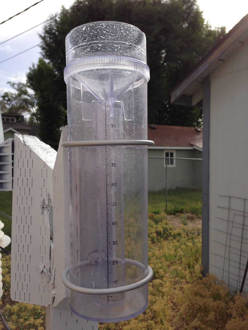

By the middle of the same decade the private end of the same habit had gone online. A doctoral student at the University of Michigan wrote a menu-driven telnet interface to real-time weather data in 1991; the service took the name Weather Underground that year, went commercial as a separate company in 1995, and now draws on observations from more than 250,000 privately owned weather stations. A readership of that shape — equipped, methodical, unpaid and numerous — is what the weather groups were talking to.
The instrument and the witness
Running under everything the branch discussed was a tension it was unusually well placed to stage: between what an instrument recorded and what a person saw.
A magnitude revised downwards past people who had watched a room shake. A rainfall figure argued against a gauge that may have been badly sited, or read at the wrong hour, or read by somebody who had gone away for the weekend. Model output set against the sky outside the window. A reported hailstone measured against a ruler, a coin, or nothing at all. Both records are real, and neither is complete: the instrument is precise about one point and silent everywhere else, while the witness covers the whole map badly.
Newsgroups were one of the very few places the two met in public and on equal terms, because the medium had no way of ranking its participants. The professional’s posting and the retired schoolteacher’s posting arrived in the same list, in the same typeface, distinguished only by what they said and by an address that a reader might or might not recognise. That is often described as the great weakness of Usenet, and in most subjects it was. In a field where a large fraction of the useful statements are observations rather than interpretations, it was closer to a strength.
Nor could either kind of record arrive as a picture. These were text groups, and the mineralogy charter’s two flat words — “No binaries” — state the convention the whole branch worked under: a specimen, a rock face, a storm structure or a cracked wall was described in prose, and from the middle of the decade pointed at with an address somewhere else. That is a real limit on what these groups could settle, and it is also why the writing in them had to be exact.
From the late 1990s the agencies stopped treating the witness half as a nuisance and started treating it as an input. The programmes that resulted — the felt-report questionnaire described in the next section, the volunteer rain-gauge network described above, the automatic collection of readings from private weather stations — are now filed under the heading of citizen science. They are more or less exactly what these groups had been doing informally for a decade, with the difference that the agency version produced a database and a map instead of a thread.
Reporting an earthquake
A felt earthquake produced a recognisable shape of thread.
First came the reports: within minutes, from people saying where they were, what had moved, how long it lasted and which way it seemed to come from. Then, some time later, an instrumental location and a magnitude, once an agency published one. Then the revisions — and the first posters, who had felt the thing, were in a position to argue with them. Then aftershocks, tracked for weeks. Then, much later and much more slowly, the technical exchange about rupture length, directivity and what the strong-motion records showed.
The order matters and it is worth being careful about it. A distributed network of readers could report a felt event quickly, because the readers were the sensors and there was no processing to wait for. It could not locate one, size one, or tell anybody where the damage was: those require instruments, and in 1994 they required instruments whose output took ten to thirty minutes to reduce. Nor could such a network do anything for the people at the epicentre, who in the worst cases had no power, no telephones and no modem. What Usenet offered in a disaster was not a warning system. It was a fast, unreliable, wide-area account of what had been felt, addressed to everybody outside the affected area who wanted to know something before the wire services did.
The second stage of that thread was itself being rebuilt while the groups ran. The United States Geological Survey’s National Earthquake Information Center, on the campus of the Colorado School of Mines at Golden, determines the location and size of every significant earthquake worldwide as rapidly as it can and passes the result at once to national and international agencies, to critical facilities and to the public. Its domestic backbone was consolidated as the Advanced National Seismic System: eleven regional networks, from Alaska and the Pacific Northwest to Puerto Rico, plus a national backbone of dedicated stations, with additional data reaching the Information Center from about three thousand stations around the world, and near-real-time results generally available within ten to thirty minutes. In Europe the European-Mediterranean Seismological Centre, operational since 1 January 1975 at the Institut de Physique du Globe in Strasbourg and since 1993 at Bruyères-le-Châtel in France, takes in seismological data from more than sixty-five national agencies and aims to publish location, magnitude and felt effects within an hour. A reader of sci.geo.earthquakes saw the tail of those pipelines: a preliminary bulletin, and then a revision.
Magnitude was the dependable source of argument, because there is no single scale and never has been. The number the press calls Richter is local magnitude, developed by Charles Richter in collaboration with Beno Gutenberg and presented in Richter’s 1935 paper, which defined it from the amplitude of a trace on one standard kind of seismograph. It saturates: past a certain size, larger earthquakes stop producing proportionally larger numbers, because the waves it measures stop growing. The surface-wave magnitude that Gutenberg added in 1945 saturates too, at around 8.0, which is why the 1960 Chilean and 1964 Alaskan earthquakes were long carried at 8.5 and 8.4 when their true sizes were nearer 9.6 and 9.3. The moment magnitude scale, defined in a 1979 paper by Thomas C. Hanks and Hiroo Kanamori and built on work Kanamori published in 1977, does not saturate, and it became the authoritative scale for large events. The Survey put its own house in order late in the groups’ life: a formal earthquake magnitude policy setting out which scale would be reported to the public for which size of event was implemented on 18 January 2002. Until then, and to a degree afterwards, published figures moved as distant stations reported in, and every move was an argument in the newsgroup.
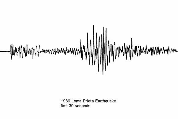

The felt report was formalised over the same years, and by the same institution. After the Northridge earthquake of 17 January 1994 — moment magnitude 6.7, beneath the San Fernando Valley at 04:30 in the morning, with about sixty dead and thousands injured — Lori Dengler and Jim Dewey ran a large household intensity survey by questionnaire, and out of the volume of returns built what they called a community decimal intensity: numerical values assigned to individual questionnaire answers and calibrated against the Modified Mercalli scale. Their survey was published in 1998. The numerical assignment was the key, because it could be automated. David J. Wald at the National Earthquake Information Center turned it into a web questionnaire whose answers become intensities and a map; Did You Feel It? has run since 1999 and has since collected several million individual reports. Wald also led the development of ShakeMap, first described for southern California in 1999, which maps the ground motion an earthquake actually produced rather than the single number at its centre.
Intensity is not magnitude, and the distinction is the whole point. Magnitude is one number for the earthquake; intensity records what the shaking did at a particular place, which is the one quantity a witness can supply and an instrument cannot supply everywhere. The programme is, in effect, the felt-report thread with a database behind it.
The period supplied the events. Kobe on 17 January 1995, exactly a year after Northridge to the day. İzmit on the North Anatolian Fault at 03:01 local time on 17 August 1999, moment magnitude 7.6, with official figures of more than eighteen thousand dead. Chi-Chi in Nantou County, Taiwan, at 01:47 on 21 September 1999, moment magnitude 7.7. A reader following the earthquake group through any of them saw the same sequence at speed: felt accounts, a preliminary location, magnitudes that moved, aftershocks, and then the slower professional exchange. This page makes no claim that any particular event was first reported on Usenet; no source establishes that, and the archive that would settle it is not held here. What the record does establish is the shape of the response and the machinery it was racing.
There is a coda. The European centre now detects earthquakes by watching its own web traffic: when the ground shakes, people who felt it go looking for an explanation, the surge in visitors can be geolocated, and the felt area can be mapped within a couple of minutes of the event — before the seismological data arrive. The technique is called flashsourcing, and it is the newsgroup pattern industrialised: the witnesses reporting first, the instruments confirming afterwards, with the difference that nobody has to type anything.
Satellite navigation, and a policy that changed a subject overnight
sci.geo.satellite-nav is the branch’s best case study, because a single administrative decision transformed what the group was for, and the decision has a date.
The group was proposed in January 1994 as sci.geo.satnav, by Andy Arkusinski and Ken Jongsma, and chartered under its final name for “global navigation satellite systems”, explicitly including both the American Global Positioning System and the Russian GLONASS, and explicitly excluding space policy in general: the proposal argued that the space segment was “almost incidental” to a subject that was really about terrestrial navigation, which is why the group sits in the earth-science branch rather than in sci.space.* — the reasoning is spelled out in the request for discussion, and the neighbouring space groups have their own pages, among them sci.space.station. Among the topics the charter names is “discussion of GNSS policy (such as GPS selective availability)”. The group was therefore created with the argument that would later define it already written into its constitution.
Selective Availability was the deliberate degradation of the civilian GPS signal: an error the military could correct for and civilians could not, holding ordinary civilian accuracy to roughly a hundred metres. An entire craft had grown up around defeating it — differential corrections broadcast by coastguards and aviation authorities, very long averaging of a fixed point, post-processing of logged data against a reference station — and that craft was a large part of what the group discussed, because it was the difference between a receiver that could find a town and one that could find a field.
It ended at once. President Clinton signed the directive discontinuing Selective Availability, and the degradation was switched off across the entire satellite constellation simultaneously, a few minutes past midnight Eastern time at the end of 1 May 2000. Civilian accuracy went from about a hundred metres to about five. Overnight, most of the elaborate technique the group had accumulated became a curiosity, and the questions changed from how to beat the error to what one could now do without it.
What one could do arrived two days later, and it came out of the group. On 3 May 2000 Dave Ulmer hid a container in the woods near Beavercreek, Oregon, and posted its coordinates to sci.geo.satellite-nav under a subject line recorded in the standard citation of the event as “GPS Stash Hunt... Stash #1 is there!”. The container was a partly buried black plastic bucket holding, among other things, software, videos, books, money, a slingshot and a can of beans. It was found twice within three days. The pastime he called a GPS stash hunt was renamed at the end of that month, on the suggestion that “stash” carried the wrong connotations, and geocaching promptly left for mailing lists and websites of its own. It is one of the few cases anywhere of a global pastime whose first act is a dated Usenet posting in a scientific newsgroup.
.jpg)
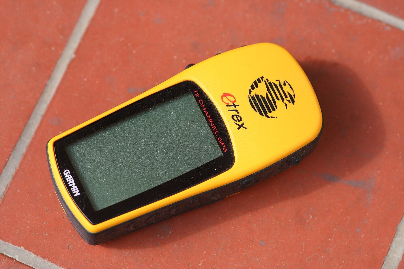
The rest of the story is institutional. The Federal Aviation Administration commissioned the Wide Area Augmentation System for aviation use on 10 July 2003, giving pilots a correction service of the kind that hobbyists had been improvising. GLONASS, named as a co-equal system in the 1994 charter, completed its constellation in 1995, decayed through the late 1990s as Russian funding collapsed, and only became a national priority again in 2001; a group chartered to discuss two systems spent most of its life discussing one. And in 2004 Steve Coast began OpenStreetMap, whose earliest data consisted of tracks logged by volunteers carrying consumer receivers — the first street entered that December after a circuit of Regent’s Park in London by bicycle. The equipment that made that possible was the equipment the group had spent a decade arguing about.
The weather year
Meteorology gave the branch something no other part of it had: a calendar. A geology group has news; a weather group has a season, and the season comes round.
The Atlantic hurricane season runs by convention from 1 June to 30 November, with activity peaking from late August into September and a climatological midpoint on 10 September. During a live storm the National Hurricane Center issues an advisory every six hours. A named system therefore produced a thread that updated four times a day for as long as it lived, sometimes for a fortnight, with a stable cast of readers and a rhythm nobody had to organise. It is worth remembering how short the horizon was: the public forecast reached three days ahead from 1964 and was only extended to five days in 2001, right at the end of the groups’ active life. The argument about where a storm would go was correspondingly sharper, because so little of it was official.
Spring did the same for severe convection in the American interior. The Storm Prediction Center — renamed from the National Severe Storms Forecast Center in October 1995, on the creation of the National Centers for Environmental Prediction, and relocated from Kansas City to Norman, Oklahoma, in January 1997 — supplied the fixed points: convective outlooks, mesoscale discussions and watches. The mesoscale discussion, introduced in 1986, is a short prose note about a specific region under threat, and it is exactly the sort of document a newsgroup can chew on: technical, timely, public and provisional. The Day 3 outlook, extending the forecast horizon another day, appeared experimentally in 2000 and became routine in 2001.
The outbreak of 2 to 5 May 1999 across the central United States is the set piece for that traffic. A hundred and forty-one tornadoes touched down over three days, with Oklahoma recording seventy of them: the state’s largest tornado outbreak on record. The Storm Prediction Center went to a moderate risk at 11:15 that morning. The most destructive tornado of the outbreak formed at 6:23 in the evening in Grady County, reached F5 intensity, ran thirty-eight miles through Bridge Creek and Moore and the southern edge of Oklahoma City, and dissipated at 7:48; it killed thirty-six people directly, damaged or destroyed more than eight thousand homes, and prompted the first use of the tornado emergency wording by the National Weather Service.
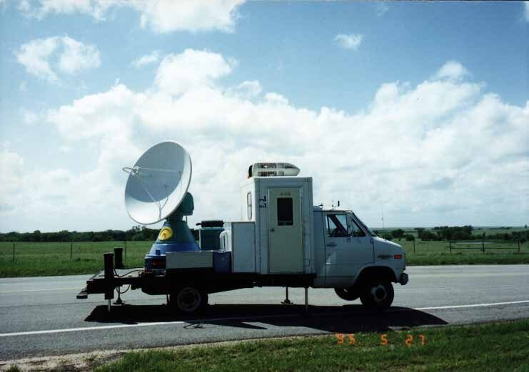
It also produced a number that was argued about for years afterwards. A Doppler on Wheels — a weather radar mounted on a lorry and driven towards the storm — measured winds of 301 miles per hour aloft, with an acknowledged ambiguity of about twenty miles per hour either way. Because the original Fujita scale defined a theoretical F6 above 318 miles per hour, the upper end of that error bar crossed the threshold, and the measurement raised an immediate question about whether the rating should change; the National Weather Service has consistently maintained the F5 rating, on the ground that the scale is a damage scale and a radar measurement taken above the surface is not a damage observation. A reanalysis published in 2021 revised the figure itself to 321 miles per hour, which is now the highest wind speed ever recorded in a tornado — but that number was not available to anybody arguing about it at the time. That distinction — what an instrument measured, against what the scale is defined to describe — is precisely the sort of argument these groups existed to have, and it is a real one that specialists were conducting in the literature at the same time.
_During_Project_VORTEX_1995.jpg)
Underneath the seasonal drama sat the daily habit: model output. Numerical forecasts were, by the middle 1990s, being published in graphical form on public servers, and a reader with a browser could look at the same charts a forecaster was looking at. That produced a recognisable genre of posting, in which somebody who was not a forecaster read a model run and said what they thought it meant, and somebody who was a forecaster explained why the model did that and why it might be wrong. The relationship with the official offices was, on the evidence of the paperwork, cordial and asymmetric: the agencies published, and the group annotated. Nothing in the preserved record supports a stronger claim than that, and a group of this kind has no formal standing with a forecast office whatever its readership.
The climate argument
The climate argument ran through sci.geo.meteorology and its neighbours for the whole of the branch’s active life, and it was conducted by three overlapping populations: working atmospheric scientists, scientists from other fields with strong views about method, and readers with no professional stake at all.
What gave the exchanges their fixed points were the assessment reports of the Intergovernmental Panel on Climate Change, established by the World Meteorological Organization and the United Nations Environment Programme in 1988, and reporting in 1990, 1995 and 2001. A great deal of the traffic consisted of parsing what those documents did and did not say, sentence by sentence. The Second Assessment Report of 1995 supplied the sentence that was argued over more than any other — its working group on the science concluded that the balance of evidence suggested a discernible human influence on global climate — and much of what followed in these groups was an argument about the weight each of those words was carrying and about who had chosen them.
This page documents that the argument happened and describes its shape; it does not adjudicate it, and the neutral-historian register is deliberate. What is worth recording, because it is specific to the medium, is the effect of the readership described above. In a group where a large minority of participants owned instruments and kept records, an argument about a global mean tended to be dragged repeatedly back to the local and the measurable: this station, this record, this correction, this siting problem. That is a real characteristic of the traffic and a real limitation of it. The ocean side of the same argument, where the heat actually goes, belonged to sci.geo.oceanography and is treated on that page.
The archives arrived while the groups were still running
The most important thing that happened to sci.geo.* was not a change in the groups. It was a change in what was available to their readers, and it happened over roughly a decade in the middle of their life.
Seismic waveforms were pooled and redistributed by the IRIS consortium, a university body founded in October 1984, whose Global Seismographic Network is the successor to the World-Wide Standardized Seismograph Network. That earlier network had been built in the early 1960s, on the recommendation of a 1959 report, to detect underground nuclear tests, and had as a by-product supplied much of the observational basis for plate-tectonic theory. Its Data Management Center made the raw traces available to anyone who asked.
Atmospheric data followed. The National Centers for Environmental Prediction and the National Center for Atmospheric Research produced a reanalysis of the global atmosphere reaching back to 1948, described in the literature in 1996 and distributed free of charge as gridded files. A reanalysis is a peculiar and powerful object: it runs a single modern forecast model over half a century of historical observations, so that a researcher can ask what the atmosphere was doing on a particular day in 1953 and get a consistent answer. Anybody with an FTP client could have it.
And then the satellites. Terra, the flagship of the Earth Observing System and the first of its spacecraft, launched on 18 December 1999 and began collecting data on 24 February 2000. The Earth Observing System Data and Information System — the thing sci.geo.eos was proposed to talk about, seven years and two ballots earlier — distributed the imagery through discipline-specific archive centres. Meanwhile the seismic networks, the forecast offices and the imagery archives all put their products on public web servers.
The effect on the groups was double-edged, and both edges matter. On one side, discussion could become analysis: a question once settled by whoever could claim the better credentials could now be settled, or at least sharpened, by two readers opening the same file and disagreeing about it in specific terms. That is the ambition in the 1991 geology charter — a clearinghouse for ideas, programs, images, data and citations — arriving about eight years late and by a route nobody had predicted. On the other side, the routine question stopped needing to be asked at all. Where was that earthquake, what is the forecast, what does the image show: by 2002 a reader answered those for themselves in a browser, and a large share of what had made a group busy simply evaporated.
Where it went
The dispersal was orderly, and it can be dated by where each constituency ended up.
The professional shop talk went to society and departmental mailing lists, which is where a good deal of it had come from in the first place: the SEISM-L and QUAKE-L generation of BITNET lists gave way to society-run lists, and those in turn to institutional portals. The routine question went to the agency websites described above. The specialist amateur went to a specialist site: mineral collectors, for instance, to Mindat, created as a private database by Jolyon Ralph in 1993 and relaunched as a community-editable website in October 2000, which does for mineral localities what a newsgroup could only ever gesture at. Weather observers went to the networks that wanted their readings — the volunteer rain-gauge network founded in 1998, the commercial services aggregating private weather stations. Navigation enthusiasts went to geocaching sites from 2000 and to OpenStreetMap from 2004. Storm chasers and mineral collectors alike ended up, eventually, on web forums and then on social media, each community in its own corner.
What none of the successors reproduces is the accident these groups depended on. sci.geo.geology put a Stanford graduate student, an oil-company geologist in Norway, a state survey geologist in California and a rock collector in Ontario in the same room, reading each other, because there was only one room and its address was easy to guess. Every successor is better at its own job and worse at that.
The end of the groups themselves is undramatic and largely undocumented. There was one moment of theatre: the control-message archive holds a run of forged rmgroup messages for the branch, timestamped within ninety seconds of one another in the small hours of 4 November 2001, purporting to come from a real news administrator and asking sites to “remove the bogus newsgroup”. They were part of a larger sweep passing through the control archive that night, and they cover every group in the branch except sci.geo.cartography, which did not yet exist. Nothing came of it — all twelve names are still in the master files, still flagged for posting — because a control message is a request and administrators had long since learned which requests to honour. Beyond that, no removal proposal for a sci.geo.* group appears in the archive, no moderator resigned, and no announcement was made. The traffic simply thinned.
All twelve names remain in the Internet Systems Consortium’s master files. Text news servers still carry them, and a reader with an NNTP client can still post to a group created by a ballot of two hundred and sixty-six people in February 1991. The Big-8 Management Board, which took over group creation and removal in 2005, has neither added to the branch nor removed anything from it. sci.geo.* is not gone; it is quiet, which is a different condition and, for a namespace, a more durable one.
Scope and limits of this page
Three limits are worth stating plainly, because this page is cited.
No message archive of any sci.geo.* group is preserved on this site. Nothing here describes a particular thread, quotes a poster, or names a participant except where that person’s name appears on a public group-creation document in the Usenet administrative record. Where a subject line is quoted — there is exactly one, for the first geocache — it is quoted from the standard published citation of that event and not from an archive read here.
There are no traffic figures, and there cannot be. The vote tallies quoted above count people who sent an e-mail during a defined ballot period; they are the best evidence of interest that exists, and they are not readership. The article counters in the master active file are placeholders that read identically for every group in it, so nothing on this page is a measure of how busy anything was. Where a proponent’s own figure is quoted — four hundred subscribers to a mailing list, three hundred rock hound clubs — it is the proponent’s claim, made to win a vote, and it is presented as that.
Finally, the paperwork is complete for some groups and thin for others. Nine of the twelve — meteorology, earthquakes, hydrology, petroleum, satellite-nav, oceanography, mineralogy, rivers+lakes and eos — are represented in the archive by an opening proposal, one or more calls for votes and a result. sci.geo.geology and sci.geo.cartography have their calls for votes and their results but no opening proposal. sci.geo.fluids has only a call for discussion, under a name it did not keep, and no result at all. Where the record is silent this page says so rather than filling the gap, which is why some groups get several paragraphs here and others get a line.